Uploading Geo-tagged Images
Creating 3D models from images
Please Note
As of March 31, 2022 we’ve consolidated our four project sizes into two:
- “Small” = Projects at or under 75,000 sq ft (formerly Residential and Large Resi/Small Commercial combined)
- “Large” = Projects above 75,000 sq ft (formerly Commercial and Utility combined)
Pricing will not change for existing users. Upon renewal, prices will reflect the same prior residential and commercial amounts. For any questions, please email us at [email protected].
Please Note
Drone images allowed per project type:
- Small: 100 - 350
- Large: 200 - 900
Uploading Images to Scanifly is easy!
Before uploading your drone photos to Scanifly, you will want to make sure that you have access to a computer with a high speed internet connection.
You also want to make sure that you do not upload any photos from our Do not upload these photos to Scanifly page and that all of your photos are geotagged
We also recommend following the flight plan recommendations in the Example Residential Imagery and Example Commercial Imagery depending on your project size and photo count.
Photo Uploading Tips
- Ensure you have a stable and high speed internet connection
- Using a wired (ethernet cable) internet connection is recommended
- Upload images from your computer rather than directly from an SD card
- Use this Upload Time Calculator to estimate how long it will take you to upload your images to Scanifly.
1. My Projects page > "New Project" Button
Navigate to your my projects page and click on the "New Project" button.
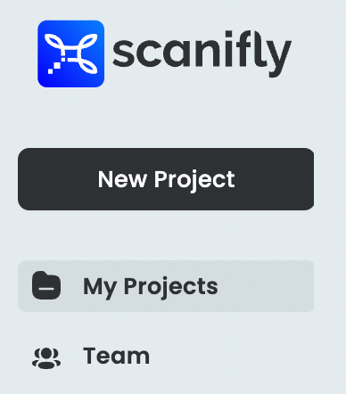
New Project Button
2. Add Customer Info
- Enter your project name
- Enter your customer's information - you can upload a single drone image and it will automatically populate the address, latitude and longitude
- You can also grab the yellow pin and move it, if it is not over the correct house.
- Click Save & Continue
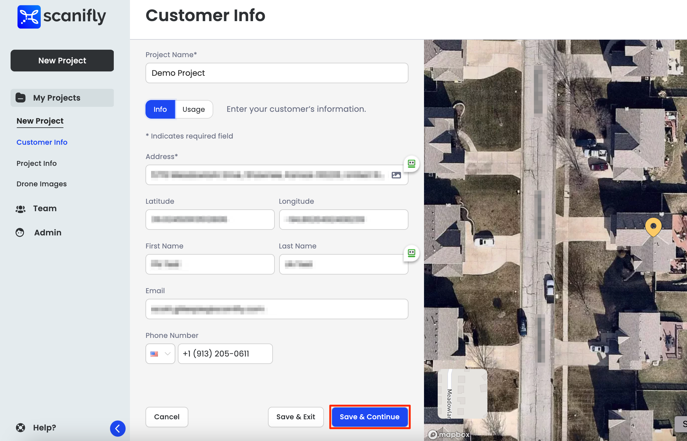
Name Your Project & Fill Out Customer Info
Customer Usage
Customer usage information is not required to upload images.
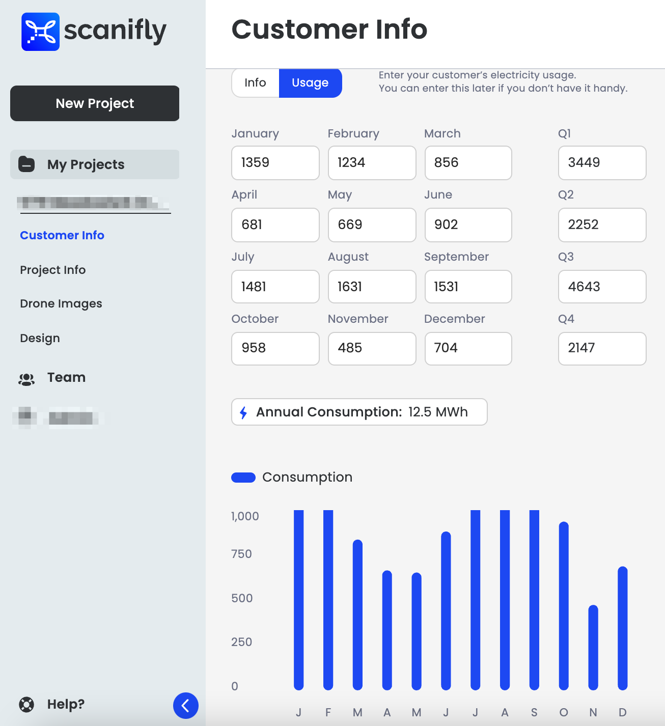
Fill Out Customer Usage Info
3. Project Info
- Add any teammates that you would like to share this project with. It can be updated at another time.
- Click Save & Continue
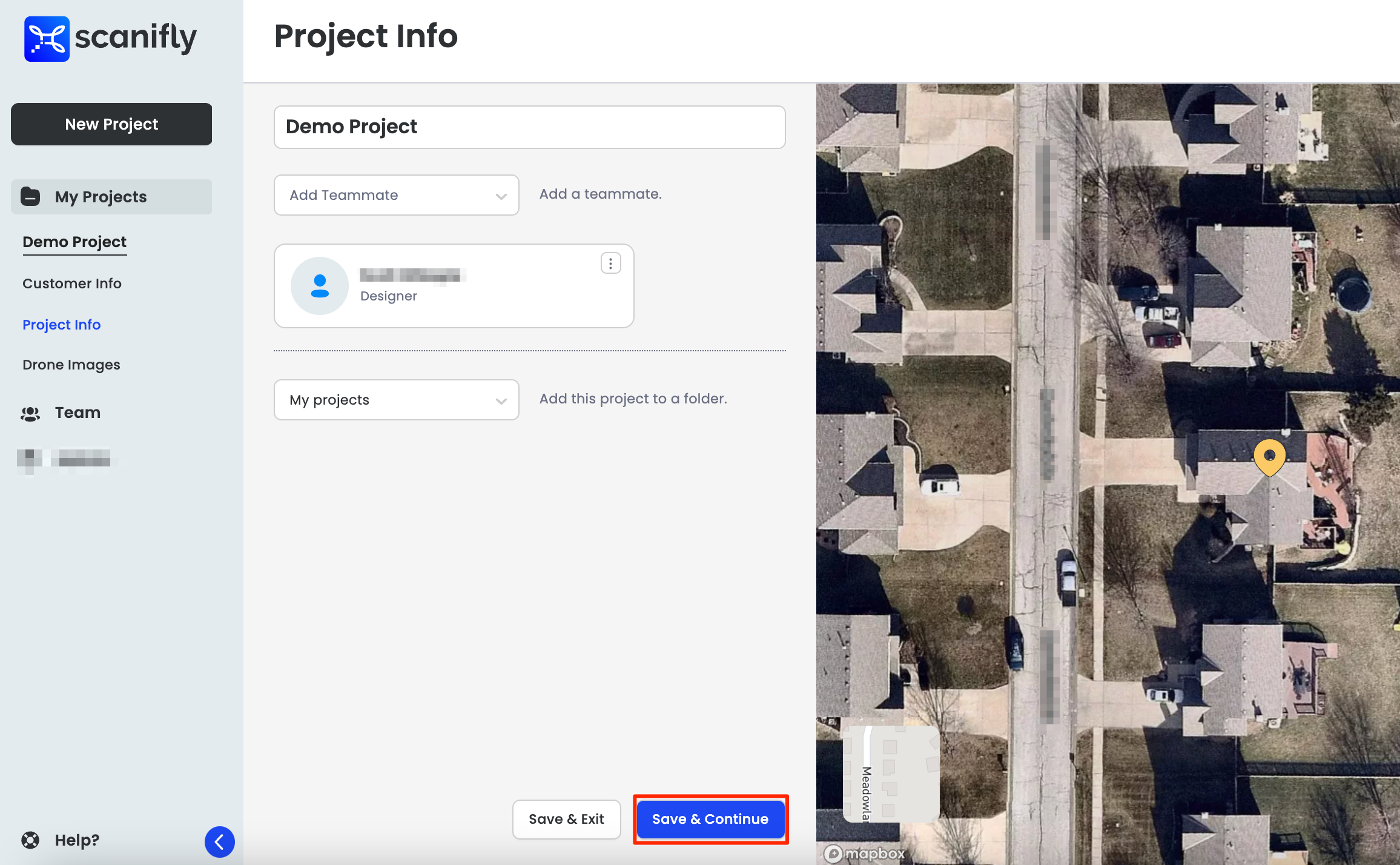
Add Project Info
4. Upload Drone Images
- Drag image files or click browse to navigate to your image folder to select and upload.
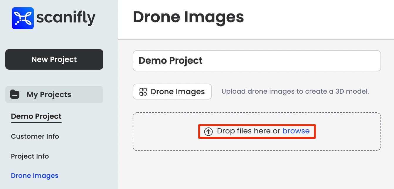
Upload Drone Images
5. Image Location review
After you have selected the photos for upload, you should see your photo locations overlaid on the google base layer in the location that they were taken, based on the image metadata.
Here you want to visually check to make sure the photos you took are showing up in the right location on the map.
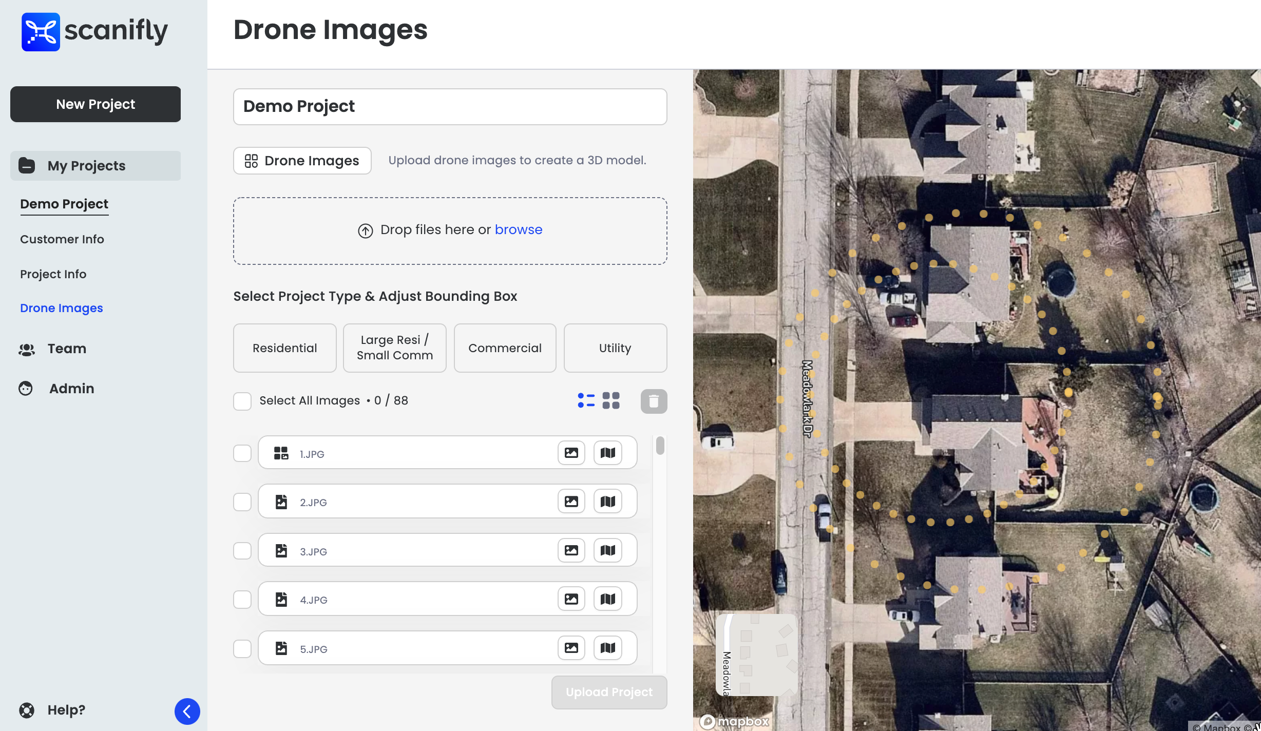
Upload window showing image alignment locations (yellow dots) overlaid on a google maps baselayer.
6. Beware of Null Island!
If you notice a view like the one below, instead of the view above, you have images in your dataset that do not contain location metadata. These images are called "Null Island" images and will need to be removed from your dataset. "Null Island" images just have coordinates of (0,0) which happens to be a location off the coast of western Africa.
Typically these images are a result of the pilot flying before they had a full GPS lock or if they were flying in an environment where they lost GPS signal during the flight. It is not something caused by the Scanifly software or upload process. You will need to review you all your images to see if all are impacted or just some. If all are impacted, a re-fly of the site will be necessary. If only some are impacted, you will want to remove them and upload the images with location metadata.
If you would like to learn more about geo-tagged images and how to resolve issues related to null islands, checkout our support article What is a geo-tagged image?.
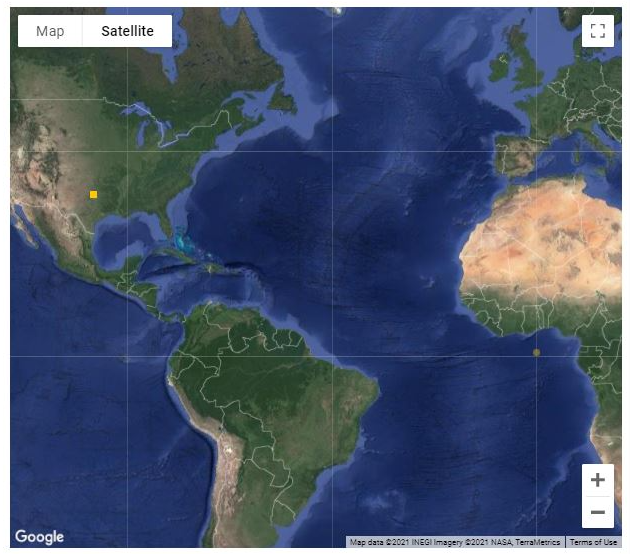
Null island photo in upload dataset example. You can see a dark yellow dot in the middle of the USA, this represents the photos that were taken at a site there. You can also see off the coast of Africa there is a lighter yellow dot, that represents the image location of the images without GPS data, which defaults to (0,0) on most off the shelf drones.
7. Image review and preview in the upload window
You can click on the yellow alignment dots in the upload window to bring up the name of the photo and a photo preview.
Please do not include any of these types of photos in your dataset.
Note: It is best to do this review outside of the Scanifly software on a computer before uploading to Scanifly, but if you notice any outlier photos be sure to remove them before uploading.
Image preview with image name in upload window map view.
8. Removing images from the dataset
You will see the list of images loaded. Simply select an image from the list or click on a yellow dot to highlight the image in the list. The trash can icon will turn red and you can then select it to delete an image. You may select multiple images at once for deleting.
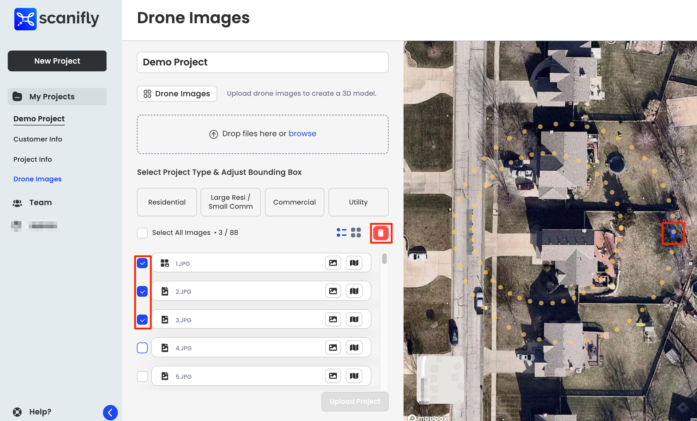
Finding an image in the image list or select from the yellow alignment dots.
9. Select Project Type & Adjust Bounding Box
Selecting a project type will overlay a bounding box onto your site. Be sure to include the entire area that you captured on site and that you would like to model in Scanifly.
As you change the size of the bounding box, the project type will adjust accordingly. If you have found yourself with a Commercial project type, simply reduce the size of the bounding box to change it to a Residential project type.
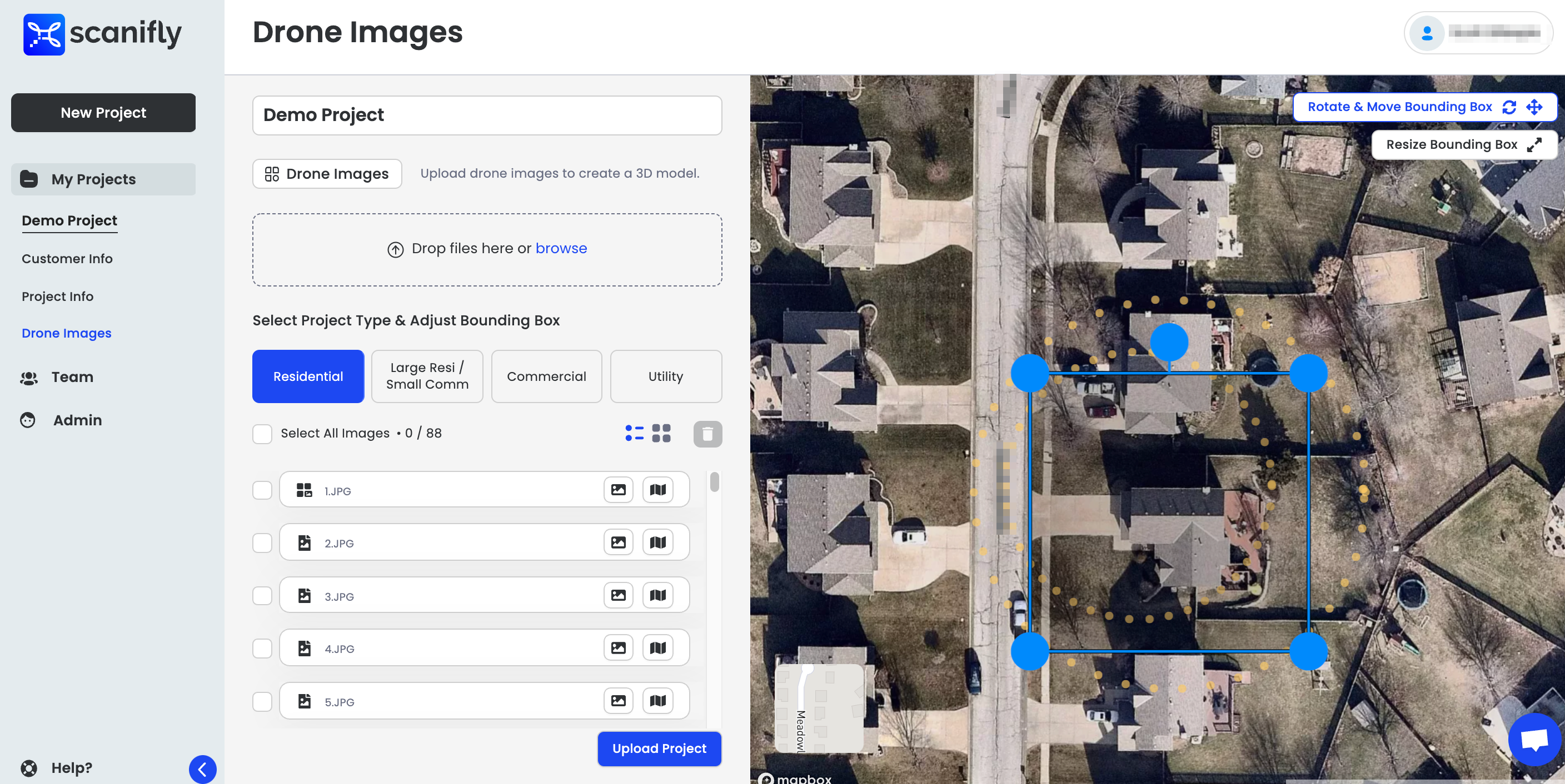
Select Project Type
10. Rotate, Move and Resize the Bounding Box
Click the Rotate & Move Bounding Box Button to rotate and move the bounding box
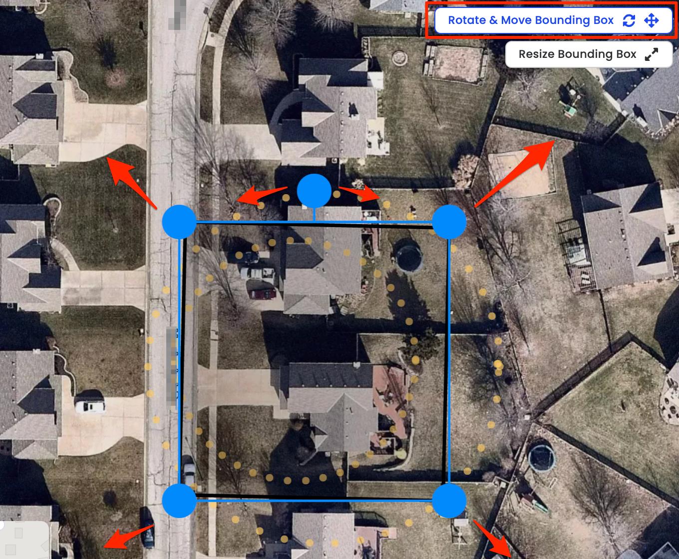
Rotate & Move
Click the Resize Bounding Box to adjust the height and width of the bounding box
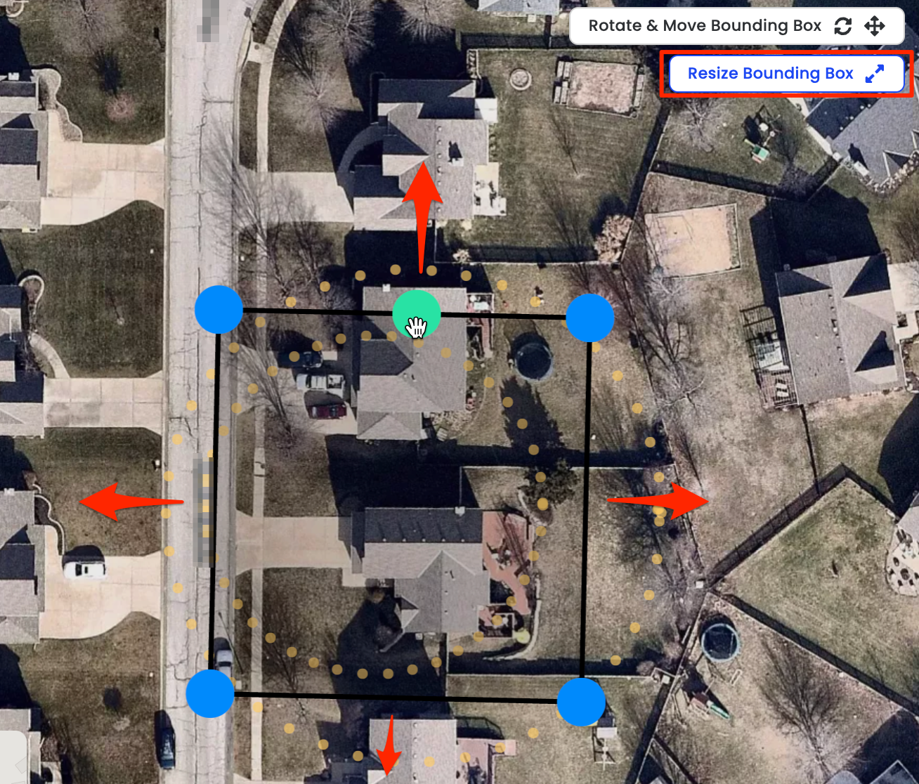
Resize
Bounding box & photo alignment locations
The bounding box does not need to include all of the photo locations. The goal of the bounding box is to define the area that you want to reconstruct. It is best to make sure your entire site and surrounding shading obstructions are reconstructed, to make sure you get the most out of your Scanifly model.
11. Click Upload Project and wait for the progress bar to appear
Depending on your internet speed, upload can take a few minutes or longer. See our System Requirements page for more information on recommended upload speed.
It is best to leave the upload window open while the upload is in progress. Until the upload has reached 100% and you see the window go away, your upload has not completed. If you have any upload problems please contact [email protected] for more assistance.
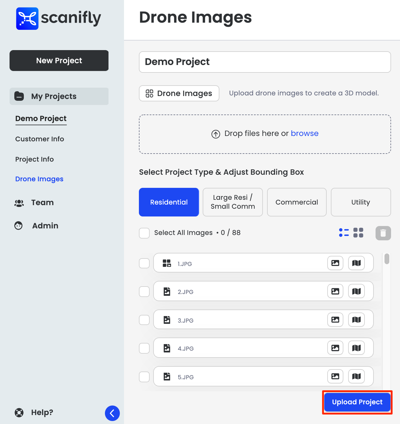
12. Wait for your project to finish processing
Typically Scanifly projects are finished processing well under 24 hours. If your project has been taking longer to process, take a look at this page.
Your projects is completed processing when you can see the Thumbnail image without the overlay "Processing" on it.
Updated 1 day ago